Solutions
From mission critical to mission accomplished
Why OSK?
OSK is the only HSI provider with proprietary satellites and detection tools designed to help optimize sustainable operations in real time.

Precise
500+ spectral bands at 100x more data
Persistent
Sub-daily capture with 7-10x more daily monitoring capacity
Partnership
Support to meet and exceed compliance
At Scale
Use cases for any industry or market
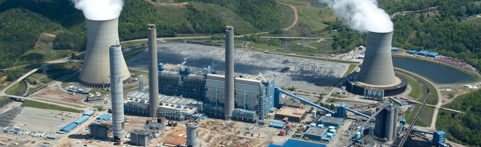
Energy
Mitigate risk and modernize detection strategies with low cost, hi-fidelity global persistent monitoring that delivers actionable insights fast so your operations can transition toward sustainability.

Case Study
iPIPE is a consortium focused on advancing emerging technologies to prevent and detect petroleum pipeline leaks. In response to a government mandate, they needed to use new technology to eliminate oil and gas pipeline leaks. OSK provided satellite and aerial asset monitoring for the Bakken and Permian basins to help detect and prevent leaks along thousands of miles of pipeline. The project continues to drive improvements in community safety, environmental performance, and overall operating efficiency.
Energy Capabilities
- Surveille Sites & Assets
- Demonstrate Regulatory Compliance
- Preserve Pipeline & Facility Security
- Detect Leaks
- Monitor Encroachment
- Validate Third-party intelligence
- Monitor Right-of-Way Intrusions
- Prevent Contamination
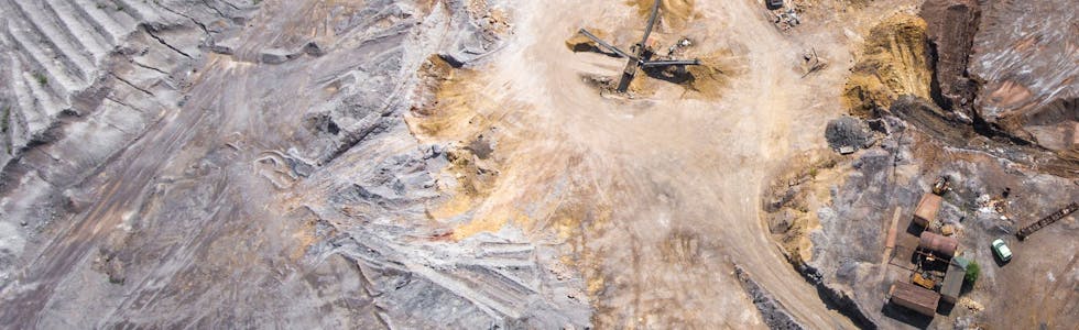
Mining
Meet regulatory requirements with ease and prospect for minerals without the dangers and expense incurred in the field.

Case Study
OSK supports mining projects end-to-end with industry-specific Spectral Intelligence™. From mapping mineralogical information to identifying unseen tailings storage facility risks, OSK hyperspectral technology supports rapid, global-scale mining and lithium exploration needed to activate the clean energy transition.
Mining Capabilities
- Identify Materials & Opportunities
- Manage & Monitor Tailings Storage Facilities
- Track Contamination Alerts
- Monitor Encroachment
- Surveille Sites & Assets
- Demonstrate Regulatory Compliance
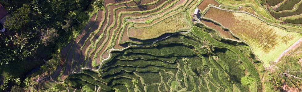
Agriculture & Forestry
Drive precision agriculture and land management with crop monitoring solutions designed to make agri-business more cost effective and sustainable at global scale.

Application
OSK uses a variety of hyperspectral and ML/AI enabled algorithms to provide insights into soil and vegetation health including early crop disease detection. Hyperspectral can detect disease before many other methods and allows growers to address the risks quickly.
Agriculture & Forestry Capabilities
- Analyze & Manage Crop Production Cycles
- Monitor Crop Health, Vegetation, & Systems Stress
- Manage Water & Evapotranspiration
- Detect Invasive Species
- Assess Soil Quality & Preparation Planning

Environmental & Emergency Monitoring
Unlock the power of Spectral Intelligence™ and get objective third-party GEOINT data for cutting edge research and better deployment of resources.

Application
Vegetative density and distribution affect firefuel and wildfire risk. OSK helps governments, forestry services, utilities and insurance companies understand, predict, and mitigate wildfire disaster with the persistent monitoring and frequent analysis of driving factors like vegetative health, weather, and topography.
Environmental & Emergency Monitoring Capabilities
- Measure Atmospheric Health
- Identify Fuel Types & Quantify Carbon Build-up
- Evaluate Soil Moisture Content
- Expose Polluted Waterways
- Predict Wildfire Spread & Behavior
- Monitor Land Pollution
- Detect Hazardous Material
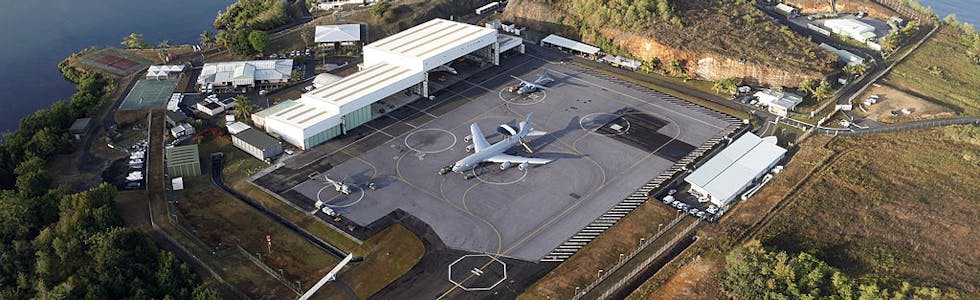
Defense & Security
Access the highest quality hyperspectral intelligence data for enhanced situational awareness and geospatial validation.

Application
Intrusion detection is essential for securing territory and defending assets. OSK combines target detection algorithms and indices to detect cases from intrusive vehicle activity to soil disruption at a given site. Detection insights are visually portrayed across image comparisons including True Color, Likelihood, Binary Image, and Fusion Binary Output.
Defense & Security Capabilities
- Enhance Aid for Relief Efforts
- Track Targets & Anomolies
- Classify Materials
- Detect Camouflage, Chemical Weapon, & Plume Signatures
- Identify Resource & Troop Movement